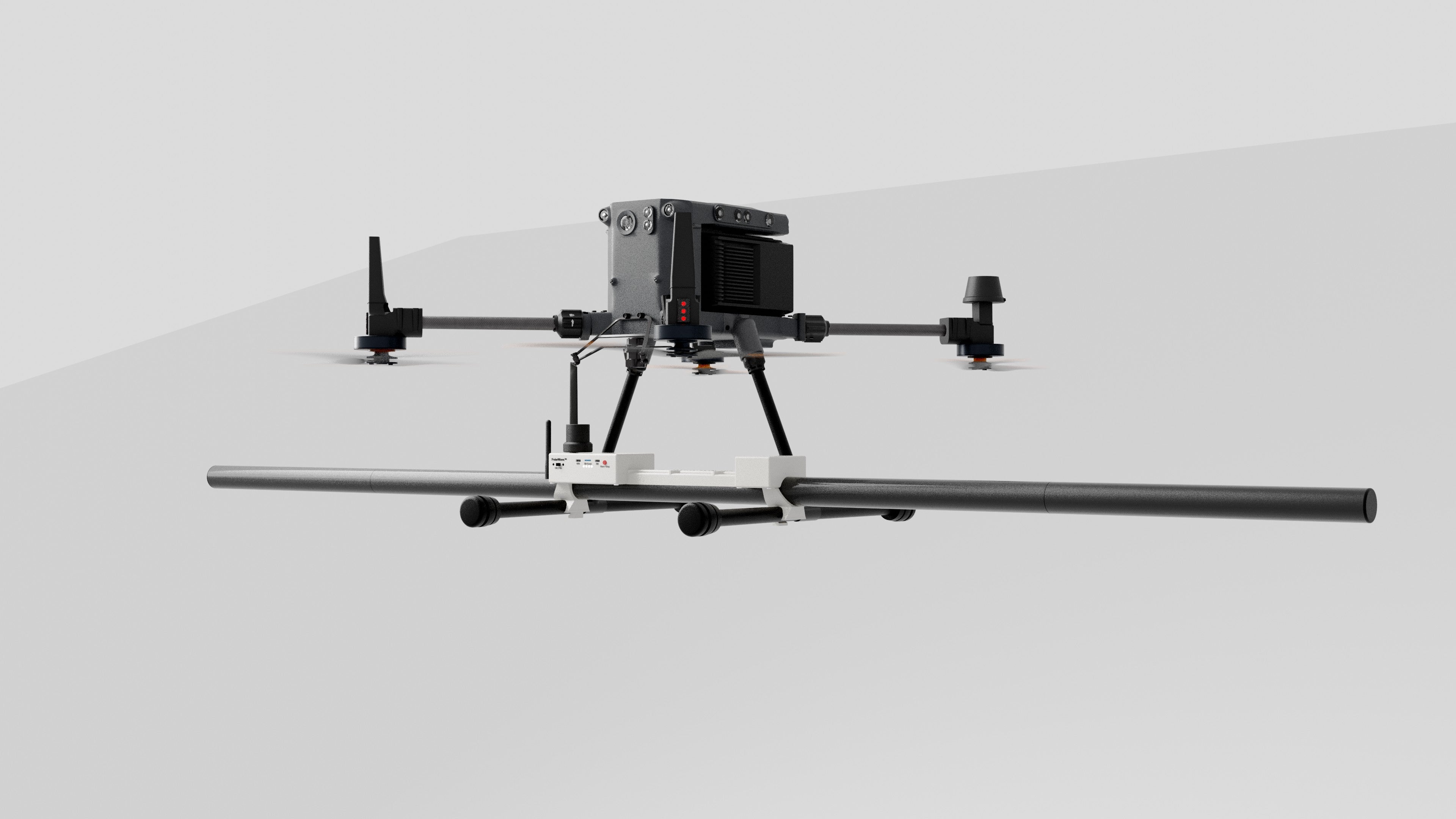

DroneRover™ Enterprise
DroneRover™ Enterprise is a drone magnetometer system that utilizes five ultra-high-sensitivity sensors to collect accurate magnetic field data.
It is suitable for scanning larger or inaccessible areas remotely.
Contact for price!
DroneRover™ Enterprise
Advanced Magnetometer System
Designed for efficient and precise subsurface exploration.
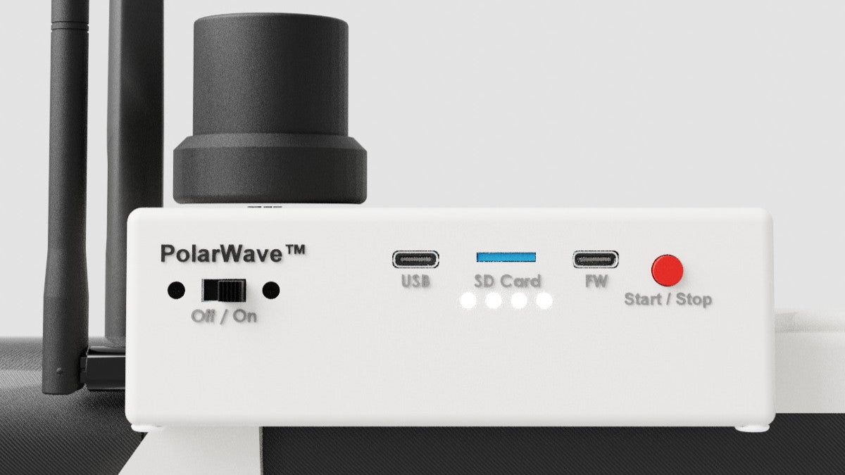
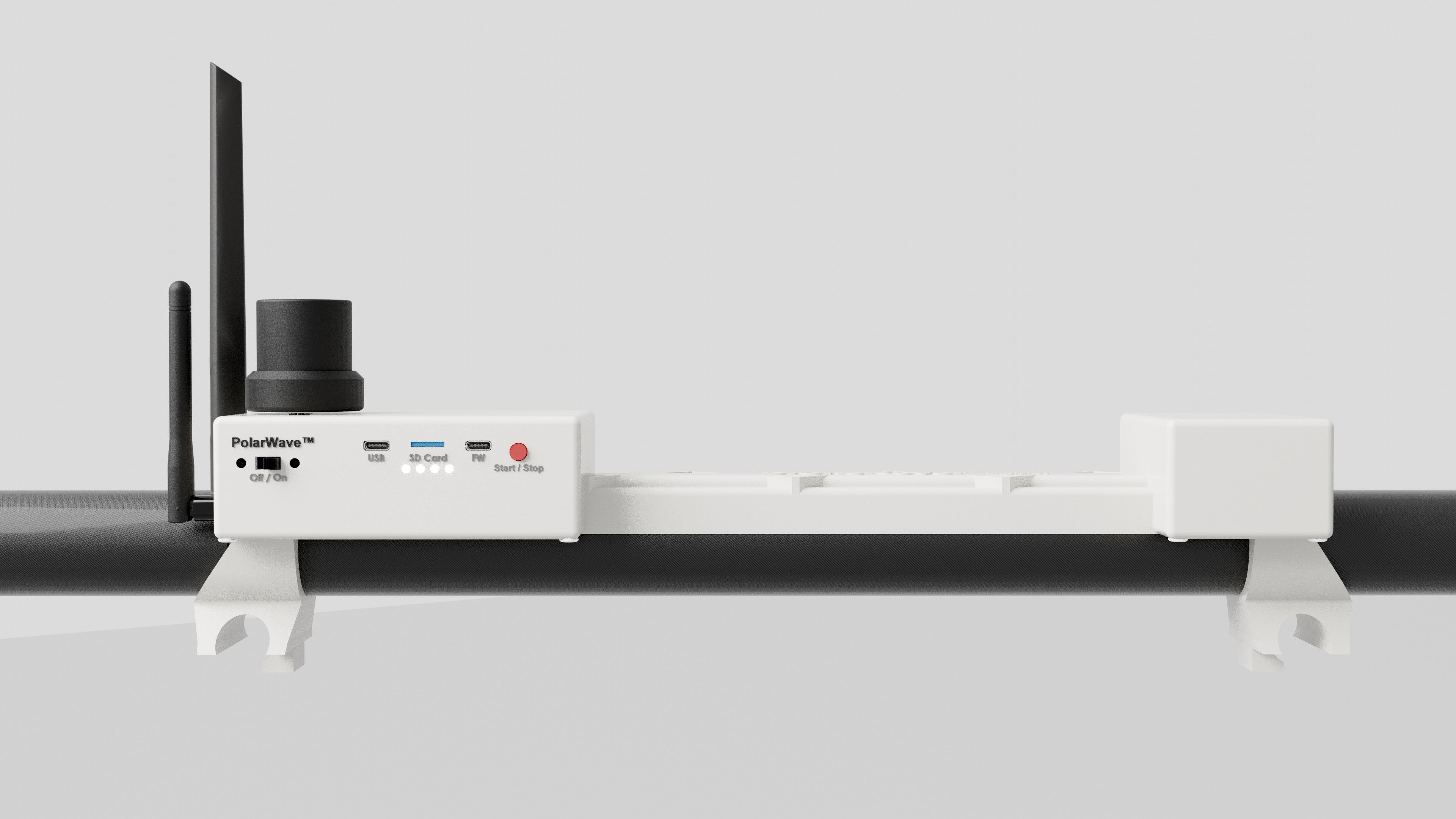
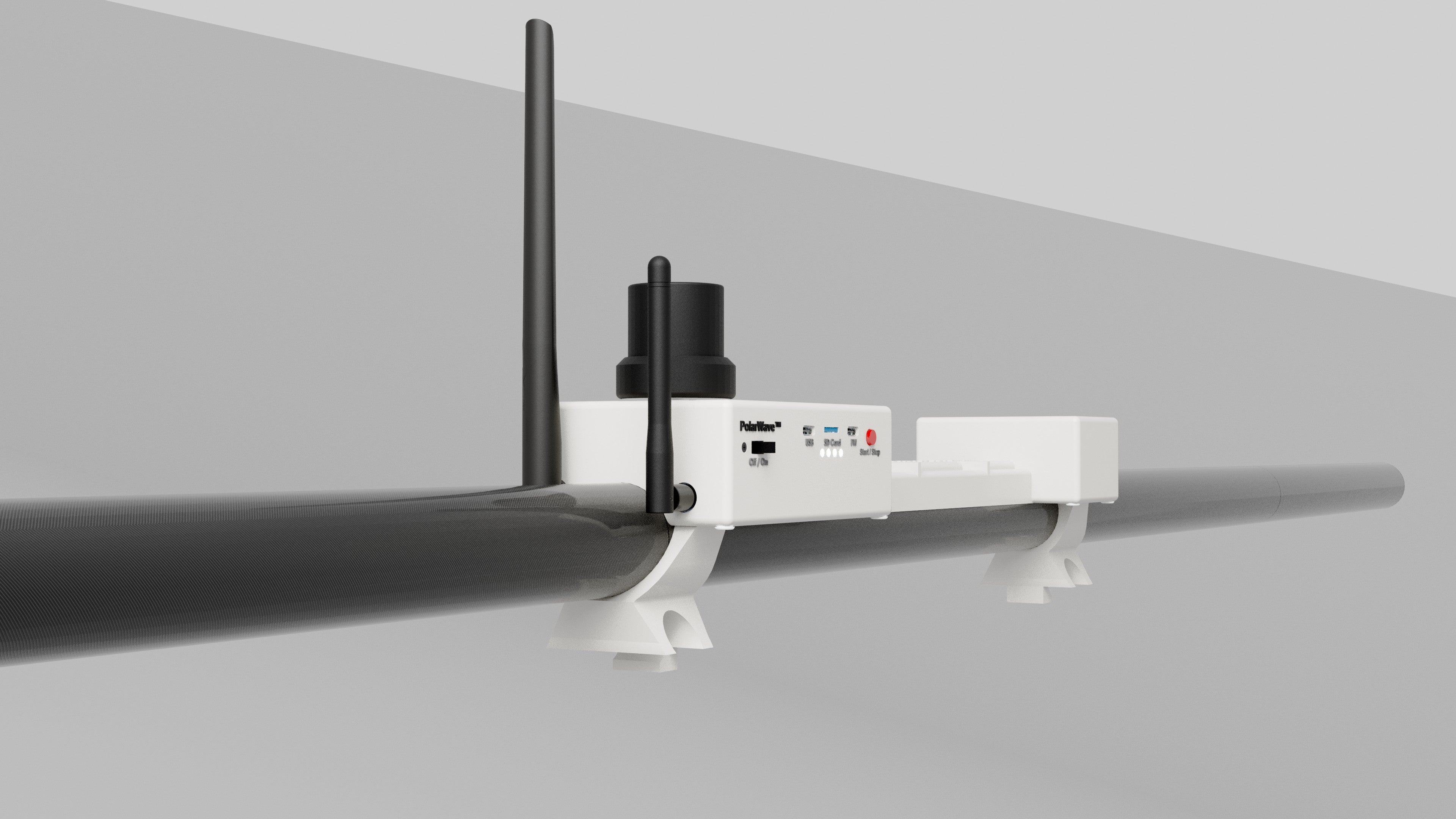
SD Card Logging
The DroneRover™ Enterprise features convenient SD card logging, allowing seamless storage of all magnetic field data during surveys. This ensures reliable data collection and simplifies post-survey analysis by enabling easy transfer to your computer or analysis software. With SD card logging, you can focus on your exploration without worrying about connectivity.
Intergrated GPS
The DroneRover™ Enterprise is equipped with an integrated GPS system, ensuring precise geolocation for all survey data.
This feature enables accurate mapping of detected anomalies and simplifies large-area surveys by linking magnetic field data directly to geographic coordinates. With the integrated GPS, you can confidently navigate and document your exploration with pinpoint accuracy.
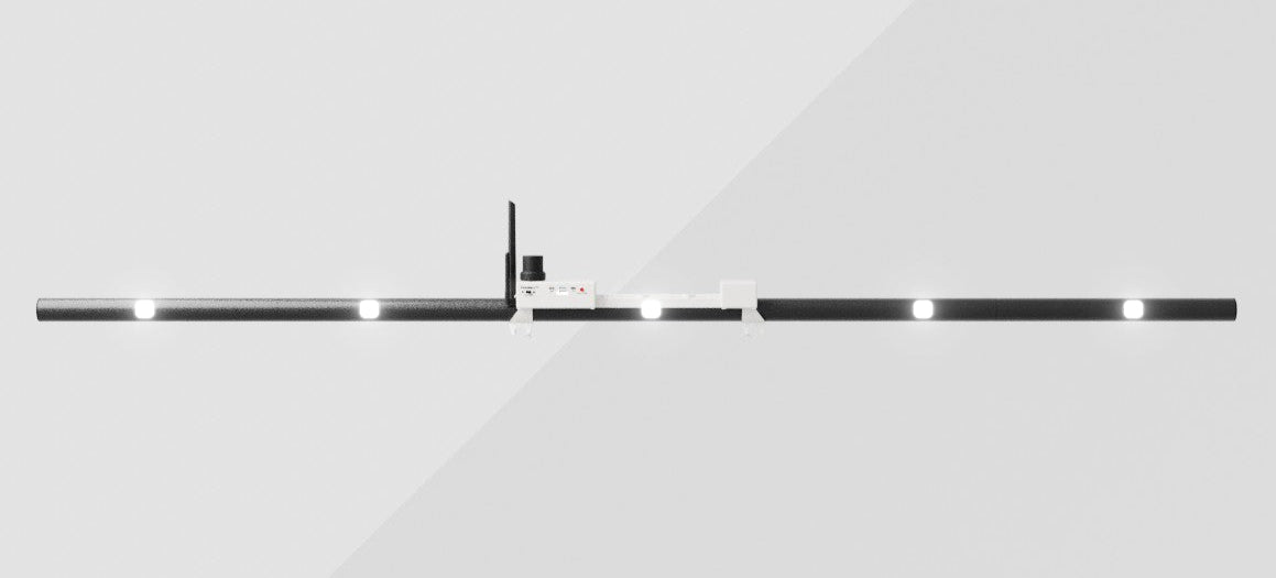
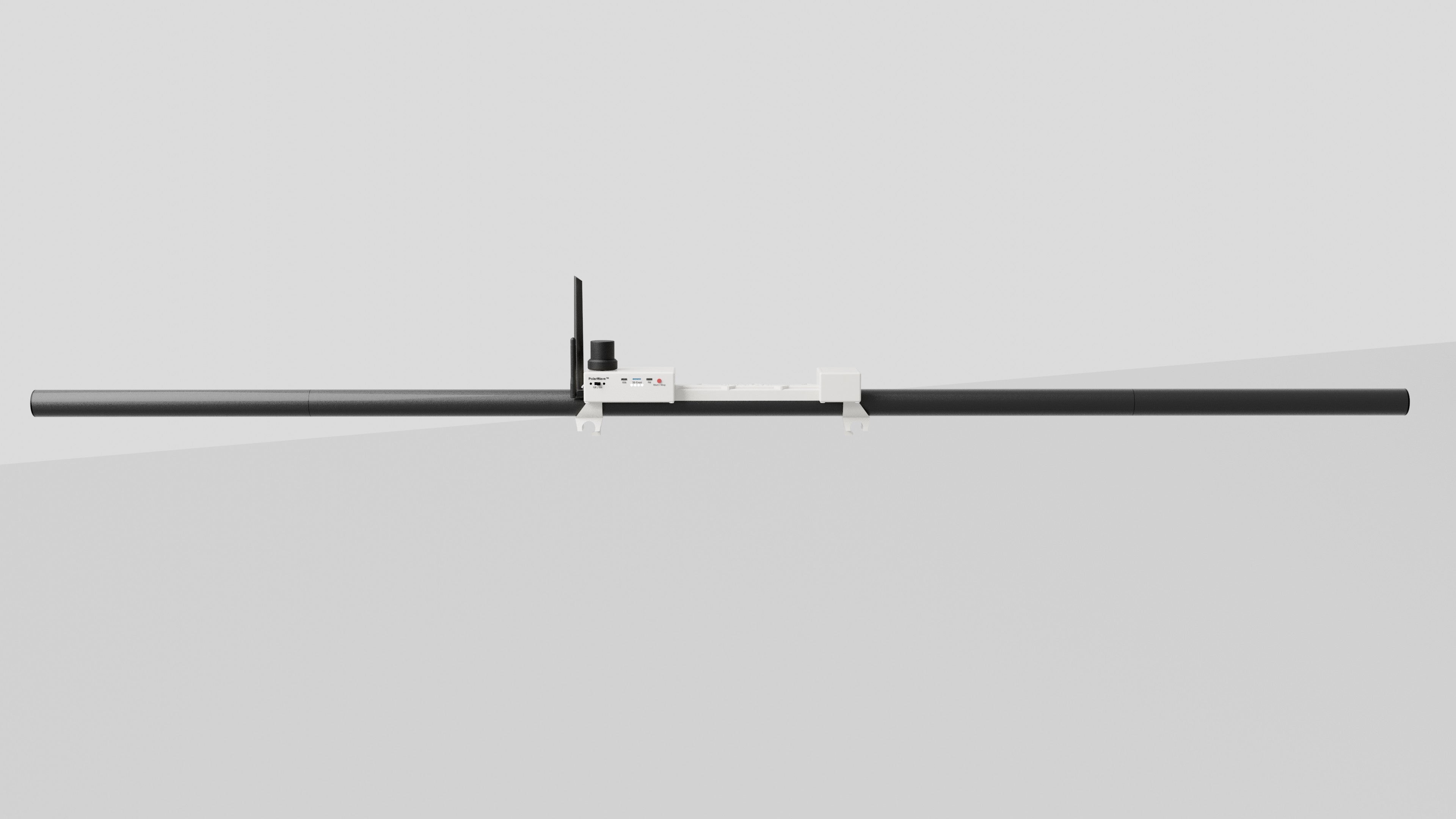
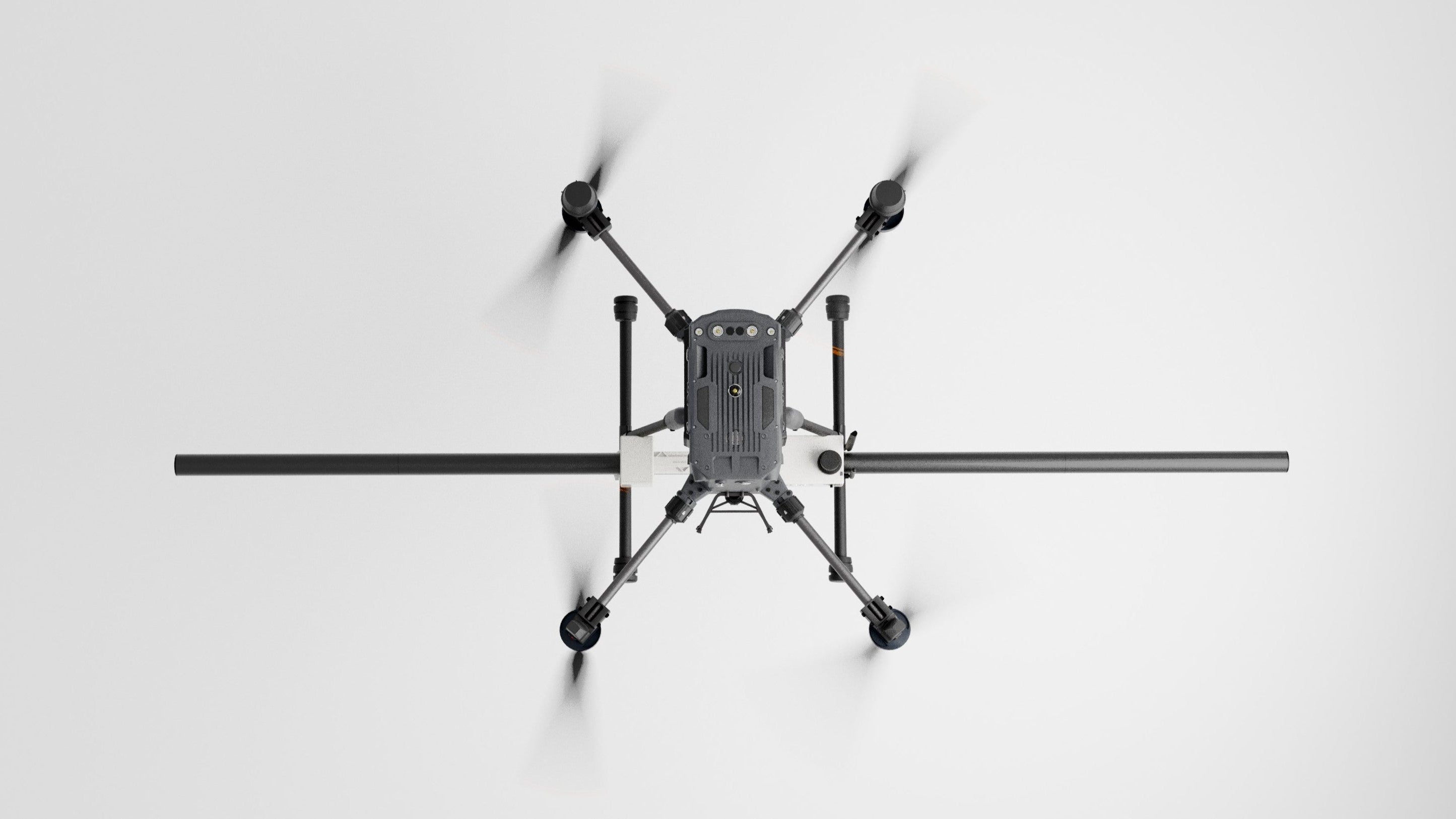
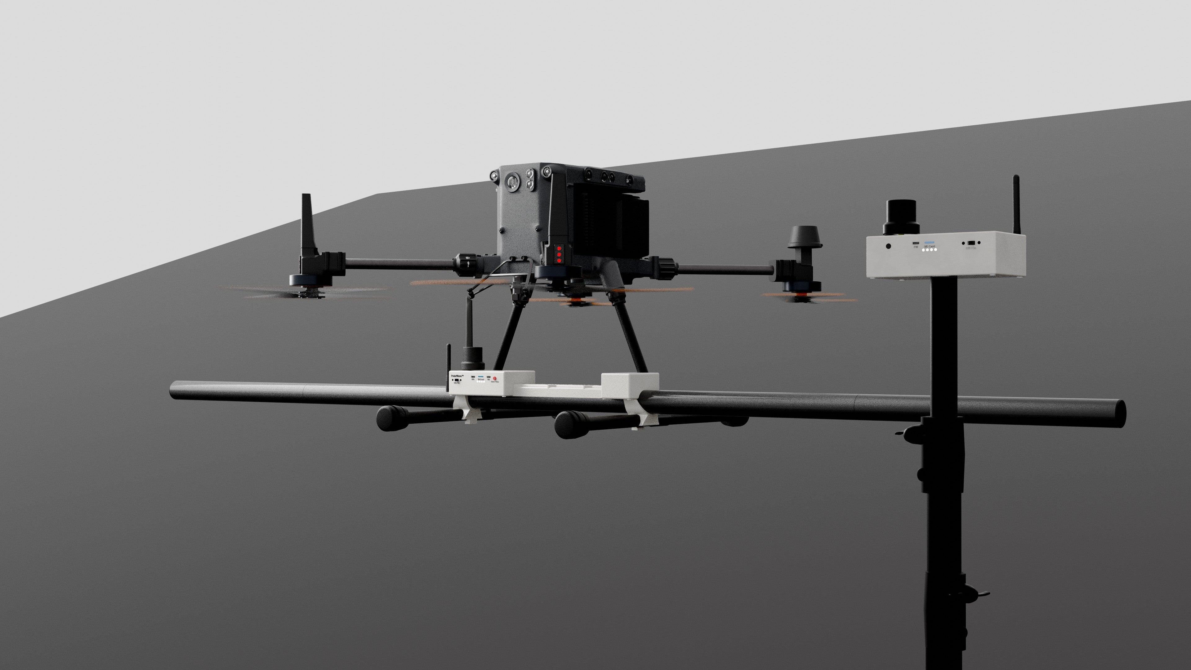
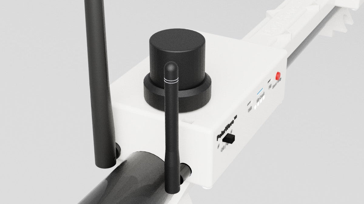
Five-Sensor System
The DroneRover™ Enterprise sets a new standard in magnetic field detection with its five ultra-high-sensitivity sensors.
This advanced configuration ensures the highest level of precision, capturing even the most subtle magnetic field variations. The multi-sensor array enhances coverage and resolution, making it ideal for detecting deep targets and conducting detailed subsurface investigations.
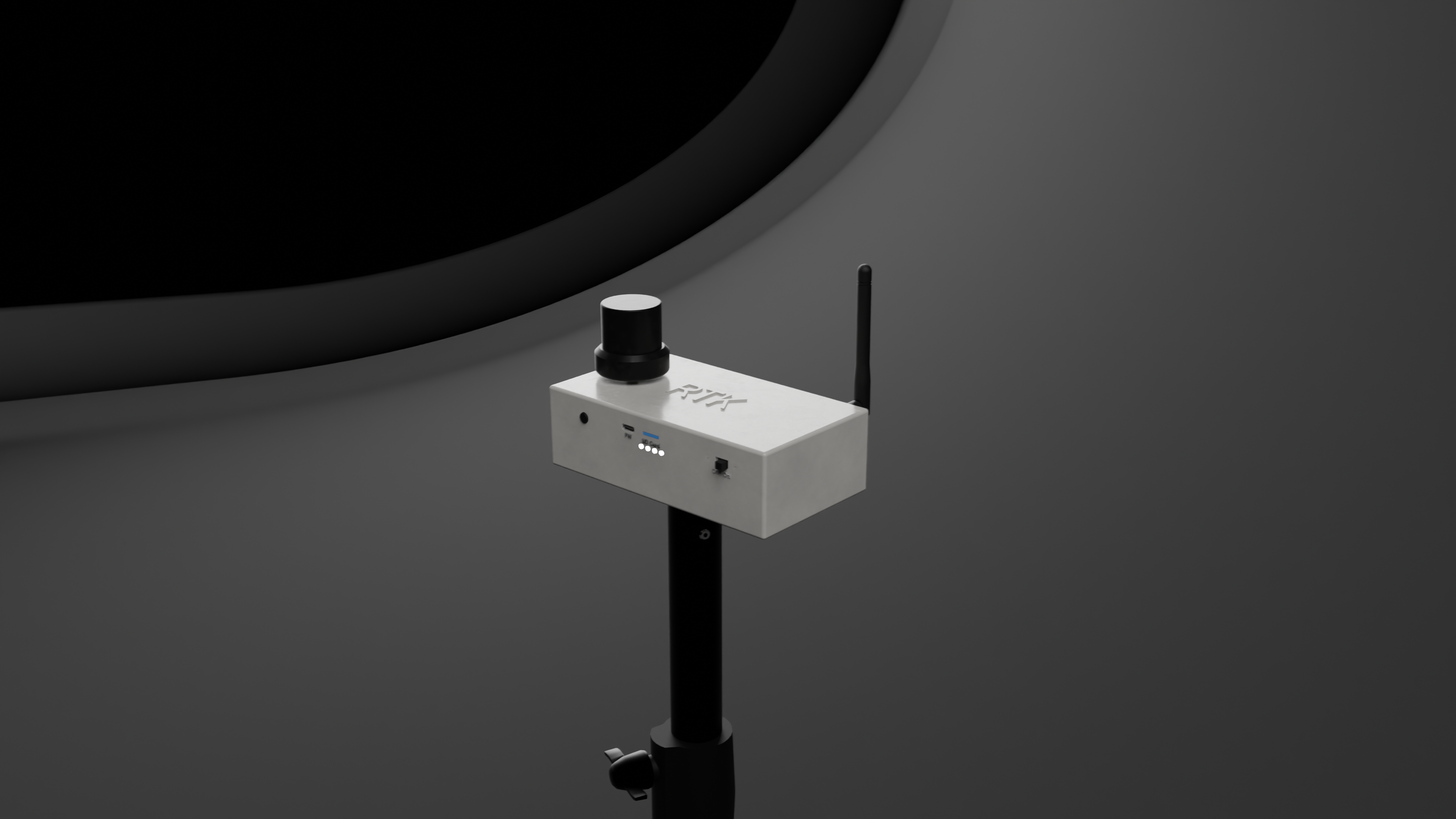
Precision with RTK GPS
The DroneRover™ Enterprise features advanced RTK (Real-Time Kinematic) GPS technology, delivering centimeter-level accuracy for geolocation. This ensures precise mapping of survey data, even in challenging environments, making it ideal for high-resolution subsurface exploration. With RTK GPS, you can achieve unparalleled accuracy in positioning, significantly enhancing the reliability and detail of your surveys.
Smart Data Correction
The DroneRover™ Enterprise incorporates advanced accelerometer technology to detect and compensate for vibrations or movement during operation. By analyzing motion data, it automatically filters out false readings caused by sensor shaking, ensuring accurate and reliable survey result.
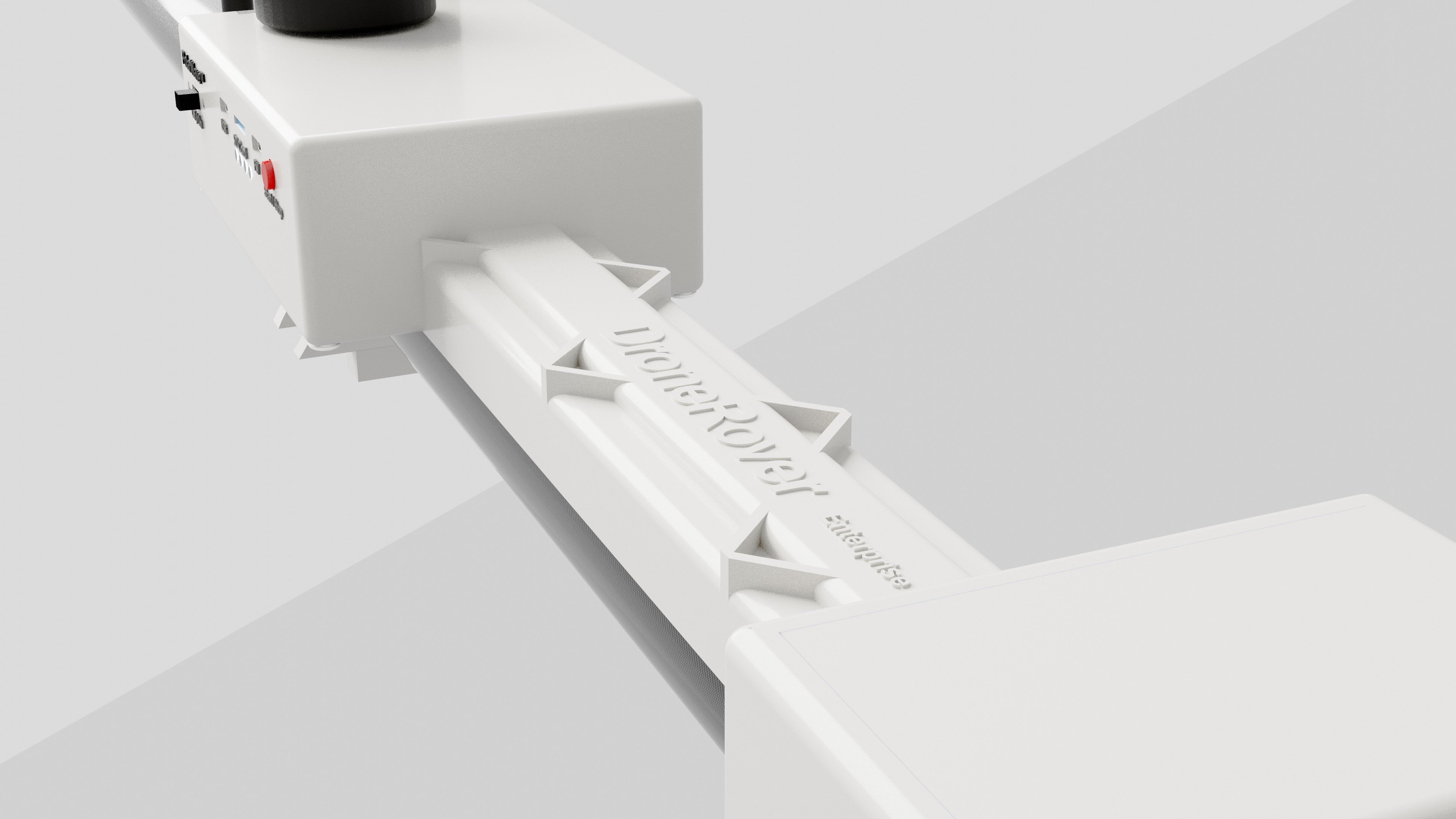
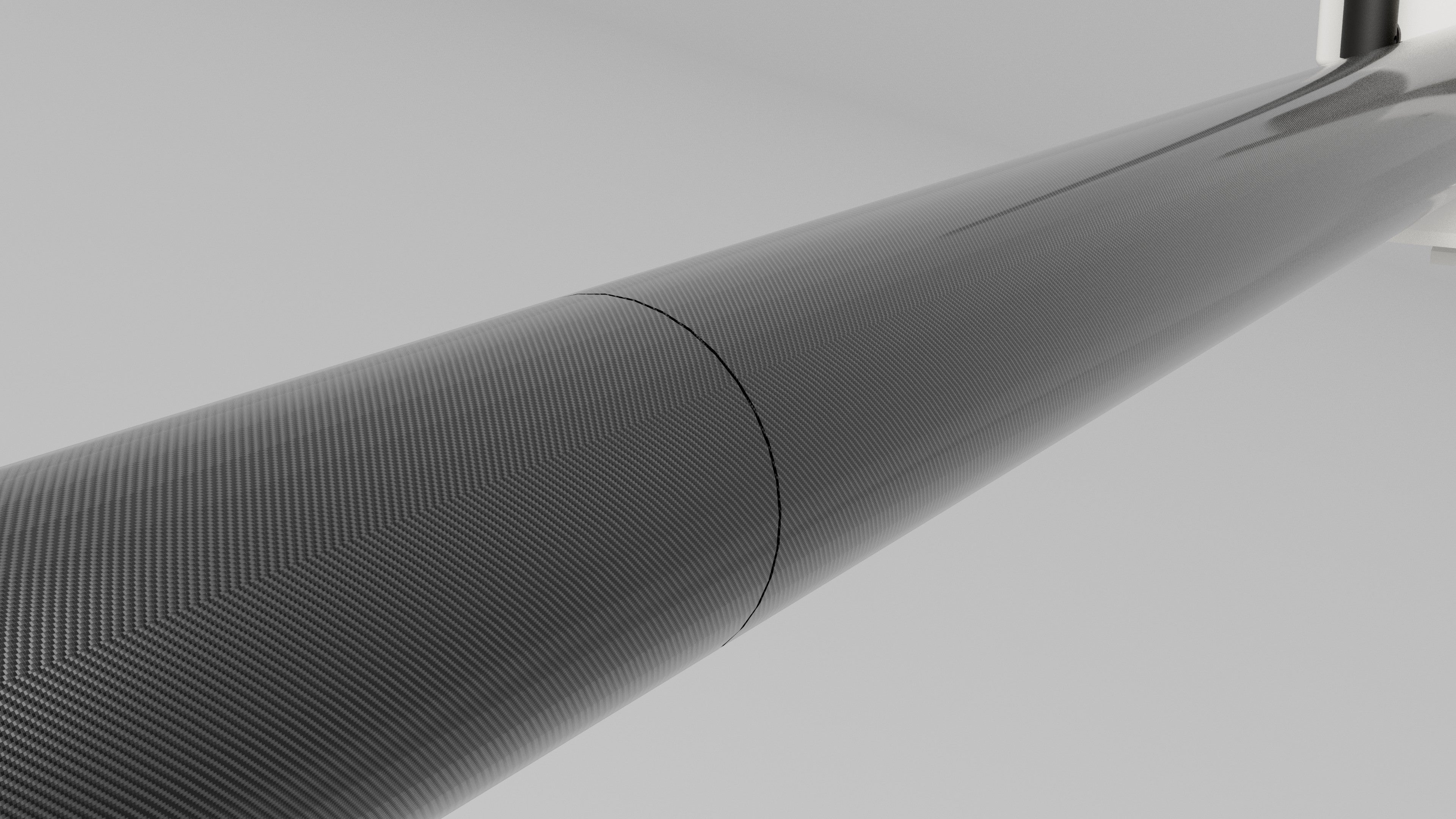
Made from PolyLight Material
Our product is developed with Polylight Material, ensuring a durable yet lightweight structure. This advanced material makes the DroneRover™ Enterprise easy to mount on lighter drones, enhancing its portability without compromising performance.
Powered by

Bartington military-grade sensors.
We integrate Bartington military-grade fluxgate sensors, known for their superior stability and sensitivity. This guarantees dependable performance for demanding research, industrial, and field applications.
For all sort of applications.
Utilities & Construction
- Cable Tracking
- Pipeline Maintenance
- Civil Engineering (Utility mapping)
Military & Defense
- UXO (Unexploded Ordnance detection)
- Mountain Rescue – Avalanche Support for Search & Recovery
- Criminal Investigations – Buried remains location
Surveying & Development
- Land Surveying
- Land Remediation & Redevelopment (Area clearance)
- Geology (Stratigraphy/sediment analysis)
- Mineral Search (Cobalt, Nickel, Iron)
Archeology & History
- Archeology (Subsurface exploration for historical artifacts)
- Cable Tracking
- Pipeline Maintenance
- Civil Engineering (Utility mapping)
- UXO (Unexploded Ordnance detection)
- Mountain Rescue – Avalanche Support for Search & Recovery
- Criminal Investigations – Buried remains location
- Land Surveying
- Land Remediation & Redevelopment (Area clearance)
- Geology (Stratigraphy/sediment analysis)
- Mineral Search (Cobalt, Nickel, Iron)
- Archeology (Subsurface exploration for historical artifacts)
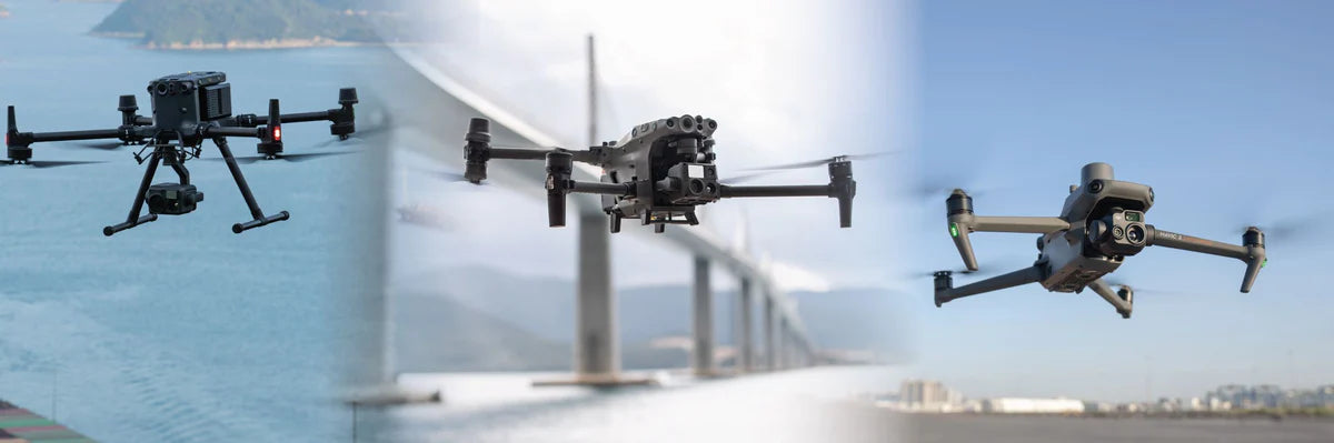
Compatible with Any Drone Carrying 1 kg or More
DroneRover Enterprise is designed for the Matrice 300 and 350 RTK drones, but it can be mounted on any drone capable of carrying at least 1 kg.
If you have a specific drone model, we can provide a custom attachment solution to ensure compatibility—just contact us.
Sensor Specifications
These are the specifications for the DroneRover™ Enterprise sensor.
5 (Build in aligned 3-axis flux-gate sensors)
Bartington Fluxgate
+-100uT (Optimized for best sensitivity)
(Different ranges available on request)
Integrated MEMS
accelerometer and gyro
0.4m
Horizontal
2m
3 to 4 ha per hour
Data Logging
These are the specifications for the DroneRover™ Enterprise sensor.
SD card 32GB (More than a month of data logging)
Start / Stop by button
.csv
(Standard format supported by most Geo mapping software)
USB C
Timestamp, GPS location and quality, magnetometer data 3-axis and vector data, IMU data
25Hz (Default) (Higher rates available on request)
1kHz
GPS Positioning
These are the specifications for the DroneRover™ Enterprise sensor.
Internal / Integrated into device.
10Hz
Multi-band L1/L5 RTK with fast convergence times and reliable performance
Centimeter-level accuracy
Supplied with unit
(Optional)
Integrated
Included
General Technical Data
These are the specifications for the DroneRover™ Enterprise sensor.
2x 3.7V 3,400 mAh
Option available on request
-20°C to +50°C
1kg
3W
Dual core 240MHz
2.45 GHz
433 or 915 MHz
CE, FCC
520 x 390 x 220 mm
Carbon & Light plastic
Data Processing
DroneRover™ Enterprise scan files are compatible with most standard data processing software.
PolarWave™ DATA, GeoHammer (SPH Engineering)
SPH Engineering Add-On Modules & Software
Upgrade your drone with advanced add-ons such as terrain-following and obstacle avoidance, engineered to enhance flight safety, boost efficiency, and deliver more accurate data.
Fully compatible with DJI M350 RTK / M300 RTK
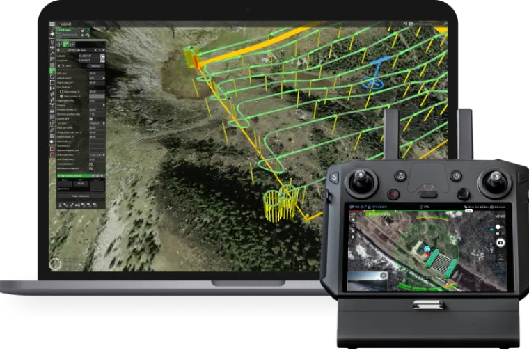
- SkyHub package for True Terrain Following
- SkyHub package for obstacle avoidance
- UgCS EXPERT (Flight Planning)
- GeoHammer Pro (Processing Software)
Speak with our trained professionals.
Distributors
Tim Ketels
PolarWave™ magnetometer solutions have completely transformed the way we conduct large-area surveys.
The system delivers outstanding precision in detecting concealed targets, making the entire process faster and more reliable. From field scanning to data analysis, everything works smoothly, saving us significant time compared to older methods.
With PolarWave™, I’ve been able to pinpoint areas of interest that would have otherwise gone unnoticed. I highly recommend their technology to anyone who demands professional, high-performance survey results.

Shai Spetgang
For a large-area archaeological survey, I remotely managed operations using the PolarWave™ magnetometer. The results were exceptional, delivering pinpoint accuracy in detecting subsurface artifacts and reducing guesswork for our client.
The seamless workflow, from scans to analysis saved time and resources, providing clear visualizations of excavation sites pre-digging, far outperforming traditional methods.
I highly recommend PolarWave™ for any team needing professional-grade surveying tools.
We will guide you though the process.
2 Years
Warranty on all our products!
FAQ
Use this text to share information about your product or shipping policies.
Do you ship overseas?
Yes, we offer free shipping worldwide.
What drone can I use?
DroneRover Enterprise is designed for the Matrice 300 and 350 RTK drones, but it can be mounted on any drone capable of carrying at least 1 kg. If you have a specific drone model, we can provide a custom attachment solution to ensure compatibility—just contact us.
How long will it take to get my orders?
It depends on where you are. Orders processed here will take 3-7 business days to arrive.
Any question?
You can contact us through our contact page! We will be happy to assist you.
Contact Us